Biography
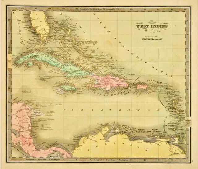
David Burr (1803–1875) was an American cartographer, surveyor and topographer. He served in several positions for the United States government, as the official topographer for the United States Post Office Department from 1832 until 1838, and as a draftsman for the United States House of Representatives from 1838 until 1840 and for the United States Senate from 1853 until 1855. He was also Surveyor General of Utah, from 1855 to 1857. He started working as a surveyor for Simeon De Witt, surveying roads in New York. Areas of the state were being rapidly developed in relation to industrialization and increased trade from the Erie Canal. He published his first atlas in 1829, the Atlas of the State of New York, which was sponsored by the state government. This was the second atlas ever created for a state. In 1832 Burr became the official topographer of the United States Post Office Department. In 1835 he published the New Universal Atlas. He also maintained the routes of the United States Postmaster Generals. He created a map of their routes, which feature details about the roads, canals and railroads. Around 1838, Burr traveled to London to collaborate with John Arrowsmith to create the American Atlas, which was published in 1839. After he returned, Burr was appointed as a draftsman for the House of Representatives of the United States. During this tenure he published: North-west-Coast of North America and adjacent Territories Compiled from the best authorities under the direction of Robert Greenhow to accompany his Memoir on the North-west Coast Published by order of the Senate of the United States drawn by David H. Burr (1840). Although some sources state that he continued in this position until 1847, he is not listed in any of the Registers of Officers and Agents, Civil, Military, and Naval in the Service of the United States from 1841 until 1847, when he turns up as a draftsman for the Louisiana Survey. In 1848, he was appointed the Deputy U.S. Surveyor for the Florida Survey and was back in Washington D.C. for the 1850 census. On January 9, 1852, the U.S. Senate resolved to employ a draughtsman to compile maps of the Federal Surveys that had been conducted. Burr was appointed this position. It was during this tenure that he put forth his last known published map: Map of the United States, 1854.
Track David H Burr
Get notifications when works come to auction, and access market analytics
Create Free AccountAlready have an account? Sign In
Professional documentation gives you clarity, portability, and confidence in your collection.
Learn why collectors document their holdings online


Your collection, accessible anywhere
Access your collection from any device with our cloud-based platform. Native mobile apps provide seamless synchronization and offline browsing, ensuring your collection data is always at hand.


Biography
David Burr (1803–1875) was an American cartographer, surveyor and topographer. He served in several positions for the United States government, as the official topographer for the United States Post Office Department from 1832 until 1838, and as a draftsman for the United States House of Representatives from 1838 until 1840 and for the United States Senate from 1853 until 1855. He was also Surveyor General of Utah, from 1855 to 1857. He started working as a surveyor for Simeon De Witt, surveying roads in New York. Areas of the state were being rapidly developed in relation to industrialization and increased trade from the Erie Canal. He published his first atlas in 1829, the Atlas of the State of New York, which was sponsored by the state government. This was the second atlas ever created for a state. In 1832 Burr became the official topographer of the United States Post Office Department. In 1835 he published the New Universal Atlas. He also maintained the routes of the United States Postmaster Generals. He created a map of their routes, which feature details about the roads, canals and railroads. Around 1838, Burr traveled to London to collaborate with John Arrowsmith to create the American Atlas, which was published in 1839. After he returned, Burr was appointed as a draftsman for the House of Representatives of the United States. During this tenure he published: North-west-Coast of North America and adjacent Territories Compiled from the best authorities under the direction of Robert Greenhow to accompany his Memoir on the North-west Coast Published by order of the Senate of the United States drawn by David H. Burr (1840). Although some sources state that he continued in this position until 1847, he is not listed in any of the Registers of Officers and Agents, Civil, Military, and Naval in the Service of the United States from 1841 until 1847, when he turns up as a draftsman for the Louisiana Survey. In 1848, he was appointed the Deputy U.S. Surveyor for the Florida Survey and was back in Washington D.C. for the 1850 census. On January 9, 1852, the U.S. Senate resolved to employ a draughtsman to compile maps of the Federal Surveys that had been conducted. Burr was appointed this position. It was during this tenure that he put forth his last known published map: Map of the United States, 1854.
Track David H Burr
Get notifications when works come to auction, and access market analytics
Create Free AccountAlready have an account? Sign In
Professional documentation gives you clarity, portability, and confidence in your collection.
Learn why collectors document their holdings onlineYour collection, accessible anywhere
Access your collection from any device with our cloud-based platform. Native mobile apps provide seamless synchronization and offline browsing, ensuring your collection data is always at hand.